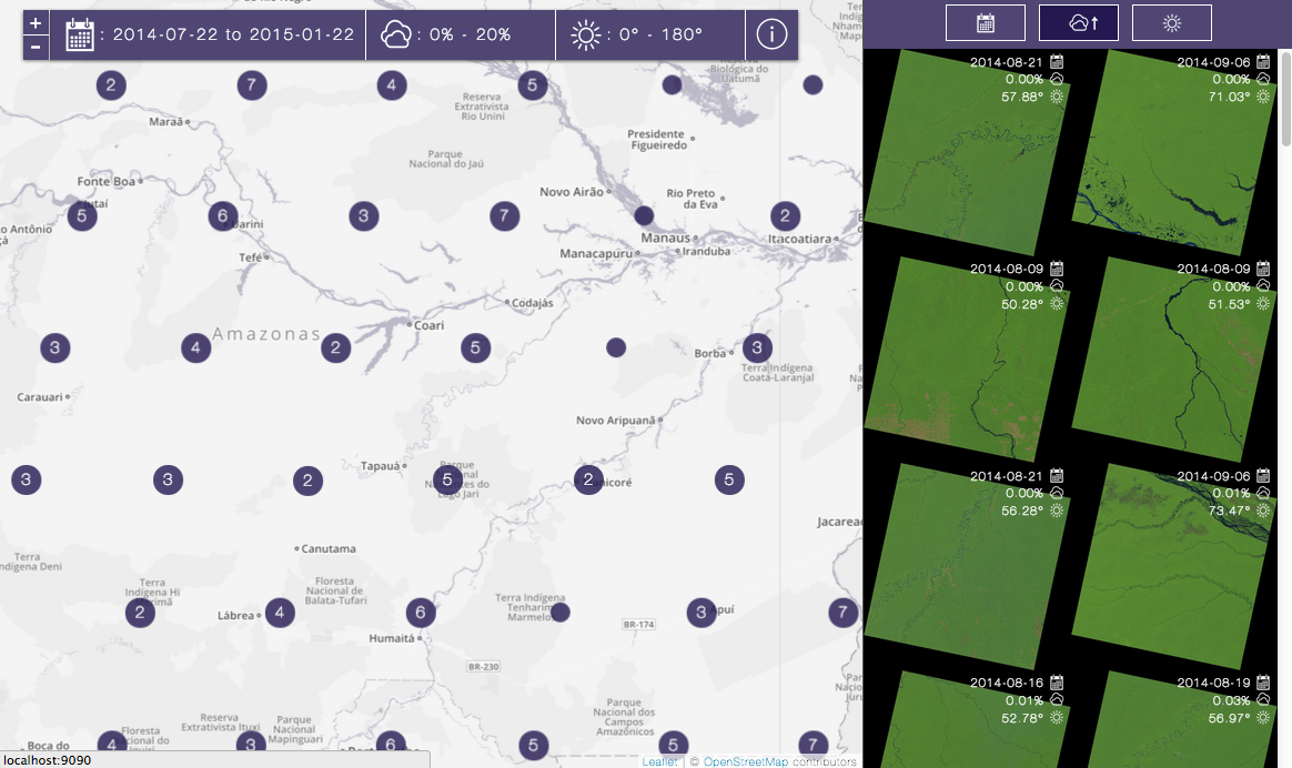
Libra is a highly usable Landsat imagery browser. Libra allows you to browse, sort, and download more than 275 Terabytes of open Landsat imagery as easily as booking an Uber. NGOs, journalists, and researchers rely on Libra as their primary tool for searching imagery.
Liberating Landsat
Landsat imagery is one of the most valuable open datasets produced by the U.S. Government. The global development organizations and governments that we work with use open satellite imagery to respond to natural disasters, to track deforestation, and to design smarter agriculture policies.
Libra makes this powerful resource accessible to more organization by making it radically easier to find, download and begin working with Landsat imagery.
Building a better imagery browser
Libra is a continuation of Development Seed’s ongoing efforts to make satellite imagery more accessible.
To make Landsat data more useful, we’ve made it easier to use. We built two open source tools for working with Landsat data - Landsat-util and Landsat API. It used to take all day for Development Seed’s imagery specialists to turn Landsat data into imagery layers for online maps. With these two tools, any developer can do it in a matter of minutes.
Libra was born out of work with Astro Digital to create the most usable imagery browser. We set the industry standard for usable imagery tools and immediately applied that standard to open satellite data.